|
CHEMIN DU ROY |
|
|
CHEMIN DU ROY |
GRONDINES

So not too far out of Ste Anne de la Pérade in the direction of Québec we find ourselves back on the edge of the flood plain again. Whether the banks that you see here are indicative of the river having changed its course to the south, or whether they are indicative of the force of the floodwaters in spring, I can't really say, but just by looking at the height of the banks, you can see just how much water used to flow down here.
The banks here are much higher and much steeper than they were back there a short while ago outside Batiscan , but then again we are closer to the river here and so the river would need to be deeper or to flow quicker in order to pass the same volume of water.
Another indication of how deep the river is today is that the MSC Washington that we saw steaming up the river near Batiscan has a draft of as much as 13 metres, and it was going upriver fully loaded without a care in the world.

Now just have a look at where that pile of wood is up there. It's all stored on some kind of embankment, and that embankment has been there at the side of the road for quite some several miles.
The embankment has some kind of flattened top and that looks to me as if it has been artificially constructed and levelled. If I had seen that kind of thing in my usual stamping-ground of North-West Europe I would have said "railway track bed" without much hesitation, but I've no idea what it might be around here. Maybe it's a trace of a former part of the Chemin du Roy. Who knows? If you do, and let me know.

Back in the car, steaming along at a rather rapid rate of knots, thoroughly distracted by one thing and another and listening to Leonard Cohen's Songs of Love and Hate at full volume, I failed to notice that the Chemin du Roy parted company with Highway 138 at the village of Grondines.
It was only that I noticed the village across the fields and that the village looked old and interesting that made me turn round and check.

It was just as well that I did because I would have missed the couple of exciting little villages, the Grondines (there are at least three of them) along this part of the Chemin du Roy.
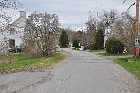
According to The Lady Who Lives In The SatNav, this is the Rue Principale, which everyone knows, is "Main Street", but according to the sign at the side of the road it is the Chemin du Faubourg. You'll need to work that one out for yourself. Whatever it is, it's an extremely pretty part of the old Chemin du Roy although they don't go much for maintenance. Maybe they think that it adds to the rustic charm of the old road, or maybe it's left like this to deter the casual motorist.
One thing for which Grondines is famous is that underneath the river there's a tunnel that runs from here over to Lotbinière on the south shore. Its purpose is to pass an electric cable, one that runs the 1487 kilometres from the Sandy Point Power Station in Massachusetts to the La Grande Hydro-Electric Power Station at Radisson, on the shore of James Bay.

We climb up a steep hill out of the Grondines and rejoin Highway 138 right at the top. And just across the road is a really stunning view right across the St Lawrence to the south bank. Somehow, "stunning" doesn't quite do sufficient justice to the view
Don't quote me on this but I think that the town that you can see way over there might be the town of Deschaillons. But I really have no idea about that.

And when I was here at the beginning of September 2013, in much better (but still windy) weather, doing my impression of Alan Parsons ... "He means 'Standing on Higher Ground'" - ed ... and I picked out yet another interesting town across the river.
This might possibly be Leclercville, one of the towns established by the Acadians following their expulsion from the Maritime Provinces for refusing to take the oath of allegiance to the British king following the capture of the French possessions over there.

If I sort out the telephoto lens I can take a closer view of the town. If the church is completely built of brick then I know that I might be right. But of course, you can't tell from here.
I shall have to go over to the south bank of the St Lawrence for a closer look one of these days. I've driven along there several times but mostly when I've been in a rush. I've never actually stopped for a good prowl around.

Somewhere over there is the town of Lotbinière and I was told by an exiled (not "expelled") Québecois ancient mariner-type of person that there is a ferry across the St Lawrence from there to Deschambault about 10 kms further along the road. If there was, it must be well-disguised, maybe even a submarine for all I know, because I couldn't see it and I've not been able to find out anything about it.
That does remind me of the retired sailor who I met a few years ago.
"I joined the navy to see the world!" he proudly announced.
"Really?" I enquired. "Which branch were you in?"
"Submarines!" he answered.
It is a little-known fact that I was once in the Navy - but of course I joined the Navy to let the world see me.
What is even less-known is that Michael Jackson once applied to join the US Navy, but withdrew his application when he was told that regardless of how the word was pronounced, the things that lined every harbour were called buoys.
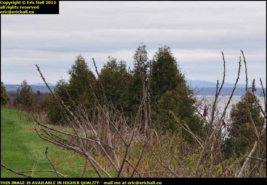
There is said to be just one meander in the whole of the downstream St Lawrence and that, I reckon, is it. If you look very closely at the far right edge of the photograph you'll be able to see the headland of the Pointe au Platon poking out into the river. The river, which is flowing north-east at the moment, turns round there and heads off in an easterly direction for a while.
In the background is the Canadian Shield and that's where I'll eventually be heading.
Where I am at this moment is in the car park of the Museum of Highway 138. It's the 1st of September 2013 and I was also here at the end of April 2012 when I took the 2012 photos and guess what? Yes, quite right. Closed both times.
But two things came to my mind while I was up here, and both of them are hoary old chestnuts that I continually rake up.
So after the unsuccessful visit to the museum in 2013 I took an interesting little diversion away from the Chemin du Roy, but you'll have to wait a while for me to tell you the story behind that.
But next morning, I didn't half have a shock. Driving back past here in the fog, I noticed that the museum was actually open. Now isn't that a first? That prompted me to stop and go in for a look around.
First thing that I noticed inside the museum was a sign telling me
"the Province of Quebec offers a welcome to all tourists who come to experience the delights that the Province has to offer along the Chemin du Roy, and has made everything possible for the visitor to enjoy his stay by providing some kind of authenticity to each site that is visited."
and it says that without a single trace of irony, which I find totally surprising because every sign and every panel in the museum, including the one above and crudely translated by Yours Truly, is written in French and there isn't one word of English anywhere.
As I have said before ... "and on many occasions too" - ed ... the big problem with the Province of Quebec is that it is living 300 years in the past when the wicked English were the enemy, and it's still fighting these age-old battles, having totally failed to move into modern times.
Yes, it probably gives the officials and the good burghers of the Province a really good laugh about how, despite the window-dressing of their "welcome to all tourists" sign, they are finally getting their revenge for a 250 year-old defeat by refusing to welcome any Anglophone tourists.
However, here's a little fact that I gleaned from the museum itself.
There's a little panel in the mueseum that states, once more without a single trace of irony, that in 1928 when the Province took its first tottering steps into tourism, over 500,000 car-loads of tourists from the USA came to visit. Yes, over half a million car-loads from the richest country on earth - say one and a half million people with the largest per-capita spending power of any other person on the planet.
Having taken note of that statement, I resolved that for the rest of my journey in 2013 I would count the number of US-registered car-loads of tourists that I would encounter.
And so I did. And how many do you think that I saw? Yes, you've guessed absolutely right. Not a single one. And we're in the first fortnight of September. And you just think of how tourism has evolved since 1928.
That's what the Province of Quebec's policy of revenge has led to. One and a half million people, with say $1,000 per head in their pockets at today's prices, and all that money is now being spent elsewhere.
Apart from that, of course, the sign is total rubbish. The Province will provide "some kind of authenticity to each site that is visited", so it tells us. But if you were with me just now in Sainte Anne de la Perade, you will recall that we found no sign to indicate where the old ferry crossing might have been. In fact, by my reckoning, 95% of the sites along the Chemin du Roy are unauthenticated.
So abandoning yet another really good rant ... "for the moment, no doubt" - ed ... I went back outside, feeling extremely disappointed with this museum. Not because of the Anglophobia (which, to be honest, is no different than anywhere else in Quebec and it doesn't bother me because I can compete quite happily in French) but because the contents of the museum, the quality of the exhibits, the quality of the accompanying documentation and the knowledge of the guy behind the counter, they all rated about 2 out of 10 and no more.
In April 2012 it wasn't just the weather that was going but the light was going too and I needed to think about accommodation. In September 2013, although it might only have been late morning, the storm and the fog that had arrived from Montreal was worsening and it was pointless to think about carrying on.
Solving the 2013 problem was fairly easy. I'd seen a truckstop at the side of the motorway not too far away and that looked promising. I toddled off to make some coffee and do some work until the weather cleared itself up.
I made a note of the time - 16:28 - that the rain stopped, but it was still miserable, grey and windy. Nevertheless, seeing as how I can't sit around here all day sulking, I reckoned that we could go for a little drive and see what is happening.
But I did make a little mental note that seeing as how I had been quite comfortable on this truckstop and there was public internet access here, then if I couldn't find anywhere better I'd come back here tonight.

And so our journey recommences along the Chemin du Roy, heading eastwards towards the city of Quebec. And here on the left, the one that it diagonally forward, is a turning that is extremely suggestive of being something to do with the old King's Highway.
Despite the assurance of the Province of Quebec's tourist board that there would be "some kind of authenticity to each site that is visited", there's no sign here which might (if you are naive enough) lead you to think that it is not a part of the old road, but my eye has caught something that makes me think that it could well be.

Did you notice in the photo above the large modern bridge in the far distance that was spanning the river - the Riviere Belle-Ile? Here I am doing a very good impersonation of Rod Steiger ... "he means 'On The Bridge'" - ed ... and in fact I'm standing in the middle. There's as much of the bridge behind me as there is in front of me and this is quite a gaping chasm
We know about Lanouiller's bridge-building techniques and he wouldn't have been able to bridge this gap. It would have taken an early Victorian engineer such as Brunel to dream up something for here. Furthermore, the banks are far too steep to consider a ferry.
Consequently Lanouiller would have been obliged to look elsewhere for a suitable crossing.

But before we leave this site, let me draw your attention to the ruined stone building that had caught my eye - just over there in the trees.
The Riviere Belle-Ile is very fast-flowing at this point and one thing that we do know about the history of the Province of Quebec that whenever a Seigneury was granted in the 17th and early 18th Century, the new lord had to provide inter alia a mill to grind the corn of the tenants on his demeure.
Seeing an old stone building by the side of a fast-flowing river is quite suggestive but there is, however, no formal indication of what this building might have been.

So having seen all that there is to see from the modern road, let's go for a wander up the old road and see what there is to see from there.
And the first thing that catches our eye is an old stone weir that one usually finds in the vicinity of an old water-mill. The purpose of the weir is to regulate the flow of water so that there is, as much as possible, an even flow of water past the water wheel regardless of weather conditions.

But turning our attention back to the road, we find that the river is not so wide at this point and that there are substantial earthen banks forming some kind of piers that infill the steep banks of the river in order to make the road more level.
The actual gap between the piers, indicated by the wooden edges and vertical pillars, is quite narrow. So recalling Lanouiller's notes, that "every bridge, whether over a stream or a ditch, has to be made of cedar trunks squared off on all four faces and fastened together with dowels of good quality, and the trunks that bridge them have to be 15 feet long and at least 1 foot thick", then Lanouiller could have bridged this gap without any special difficulty.
As an aside, for what it's worth, there's a Bed-and-Breakfast place just here and it is called the Auberge du Chemin du Roy. That might be suggestive too, but one has to be very wary about taking for granted anything that one sees that might be being used as a magnet to draw in the tourists.
Just a little further on from here is a car park with facilities. I pulled up here but immediately had a feeling of déjá vu and I seemed to remember on one occasion having a "frank exchange of views" with someone on one occasion in the past when I was on this car park, although I can't remember what about and I can't see anything at all in my ... "copious" - ed ...notes of my voyages to give me a clue.
But anyway, there was no hot water on tap and consequently no shave, but I did manage a quick wash and a scrub. I also filled two of my three water containers - using the jug in the sink because someone had pinched the handle off tap outside. As for the third water container, that had more holes in it than Crewe Alexandra's defence and so it was filed under "B"
My wash bottle was empty too. If you know those containers of liquid soap that you buy - I have one that I've filled up with water and put a small amount of liquid soap in. I use that for washing my hands and face, and anything else when I can't find anything better. So that is now filled up with water and a couple of squirts of Québec Tourist Board liquid soap, for which I am extremely grateful.
©