|
CHEMIN DU ROY |
|
|
CHEMIN DU ROY |
DONNACONA
Just a few miles out of Cap Santé in the direction of Québec is the site of Fort Jacques Cartier, and this is our next port of call.
The road that I am looking for is the rue Notre Dame - the Street of Our Lady. That was formerly part of the original Chemin du Roy and so that's a good place to begin our exploration.
So here we are, the rue Notre Dame on our right. with grateful thanks to The Lady Who Lives In The SatNav. She's quite a useful travelling companion at times like these.

And BINGO!, in a manner of speaking. What we have here is the pont du Fort de Jacques Cartier - the Fort Jacques Cartier Bridge. It's true that I've not actually found the fort, but I'm clearly in the correct place.
And almost as if to celebrate my discovery, that strange and weird gold circular object that we sometimes see above us tries to penetrate the doom and gloom of the morning. It's all happening here, isn't it?
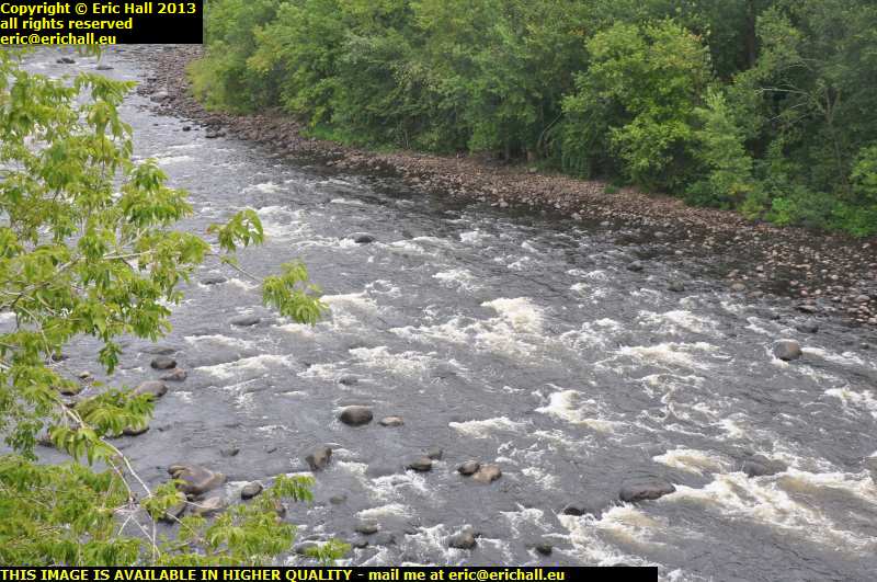
We are actually looking down at the riviere Jacques Cartier, and I do have to say that where we are is probably not actually the site of the original river crossing.
The original route of the Chemin du Roy had several ferry crossings on it. Some of these were bad and the one across the riviere Jacques Cartier was descrbed as "the worst of the worst". Once the British had taken over, Guy Carleton, who was 1st Baron Dorchester and "Lieutenant Governor and Administrator of Quebec" suggested building a bridge further upstream from the ferry crossing in order to ease the route.
Just looking at the river right now in early September, someone reasonably fit, strong and athletic might perhaps be able to cross over on foot, but I imagine trying to cross here on a ferry in May or June would be ... err ... well, exciting to say the least.
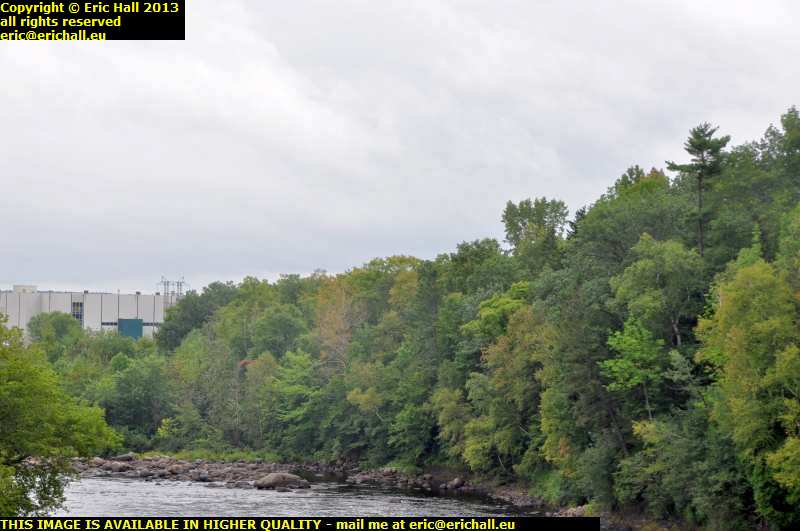
Just down there to the right of that big building is where the riviere Jacques Cartier enters the St Lawrence and so I would have expected the fort to have been somewhere round about there on any reasonable viewpoint overlooking the maritime traffic heading inland.
But I really do find it astonishing that no-one seems to have said too much about the fort and tried to re-create it. There's not even a monument or plaque as far as I have been able to see.
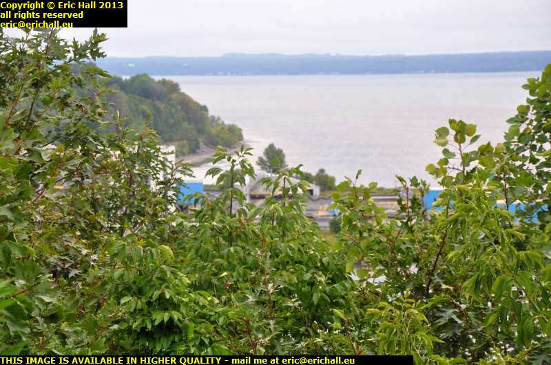
A little way further round, I can find a good spot to take a photograph of the factory that we saw in the previous photo.
It's not a very good one of the factory but my attention had been drawn to the headland over on the left behind it. The fort would have been built on somewhere like that, but I ruled that out particular site because it's so easily overlooked from the surrounding hills as you can see. The last place in Nouvelle France to hold out against the British must have surely been somewhere special.
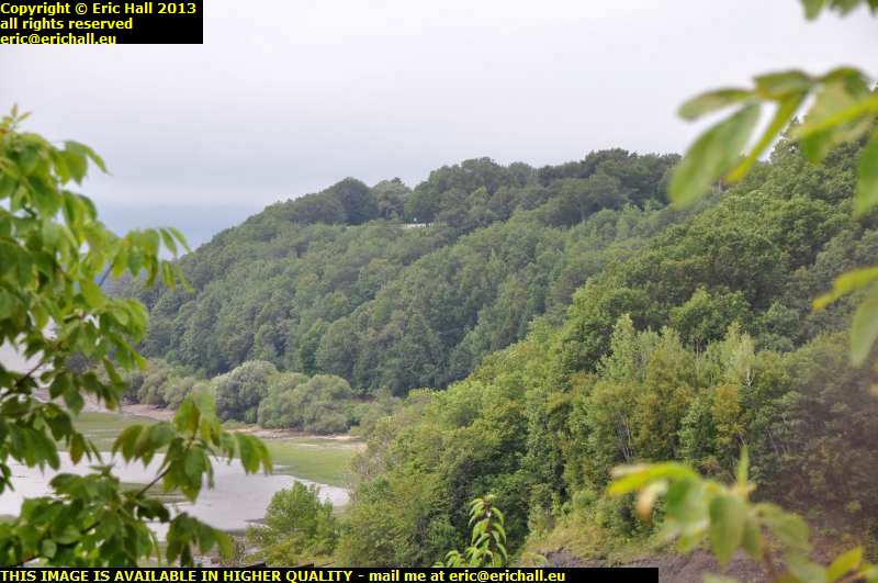
Nevertheless, I went for a drive out that way to see what I could see and sure enough, across the other side of the river is that beautiful flat-topped headland.
It's in a really good commanding position overlooking the St Lawrence, controlling the confluence with the riviere Jacques Cartier and guarding the entrance to the port of Donnacona, with a lovely steep climb up from the river that would slow down any group of attackers.
If I were going to bulld a fort anywhere around here, it would be over there on that headland.
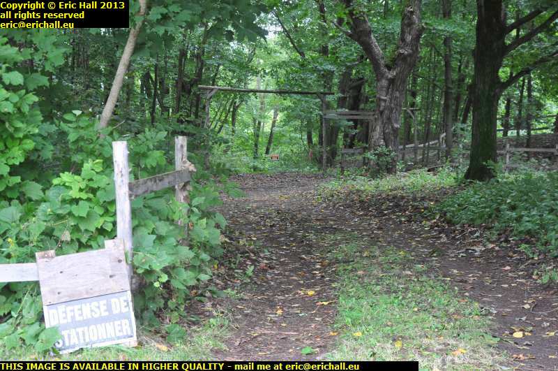
That set me off driving around every little bit of road that I could find, to see whether there was a footpath that led anywhere up onto the headland. And after about an hour of fruitless searching, this is the best that I can do.
Here's a path that looks like it might head in the correct direction, but it has "no parking" and "privaye property" signs plastered all over it. Clearly the owners do not welcome visitors. And of course there is no guarantee that it is the correct road anyway, but it's the only one that I could find.
But it really does astonish me that
We're here in Quebec after all, and I would have expected the Quebecois to have really made something out of such a historic place as this.
Mind you, the thought has not escaped me that I might be in totally the wrong place and that I have managed to miss completely a magnificent rebuilt fort a couple of miles away that contains piles and piles of mementoes of life in the last days of Nouvelle France and has battle re-enactions every Sunday and Public Holiday.
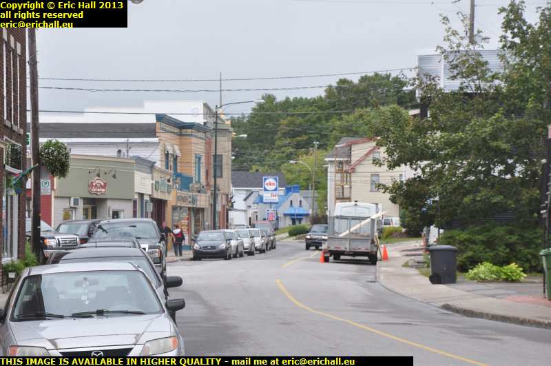
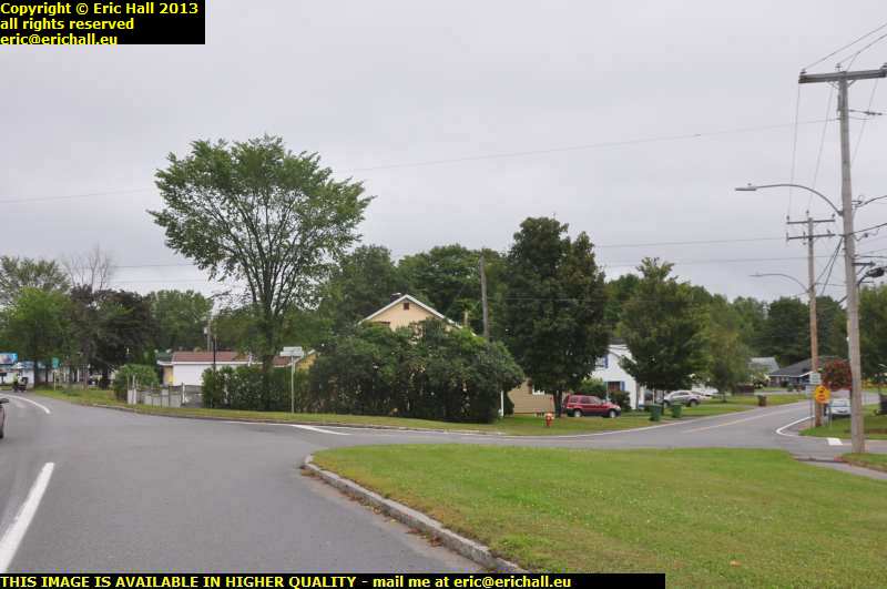
Down at the bottom of the hill is the town of Donnacona, and I find myself in the rue Notre Dame, which, as I said earlier, is stated to be a former part of the Chemin du Roy.
It needs to be checked out of course so I park up the Dodge in a convenient spot and go for a walk ino the town. I'm on the eastern side of the town here and walking back towards the west, but as our route is taking us towards the east then you will need to reverse the order of these photos, if you see hat I mean.
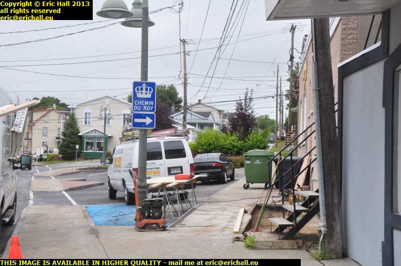
So yes, we are clearly on the correct road. The Province of Quebec has even erected a sign to help us on our way just here.
You may recall that the Province claims to have
"made everything possible for the visitor to enjoy his stay by providing some kind of authenticity to each site that is visited"
but as we are seeing with depressing and monotonous regularity, the Province's claims fall a long way short of reality. There wasn't even a hint of anything at the site of Fort Jacques Cartier.
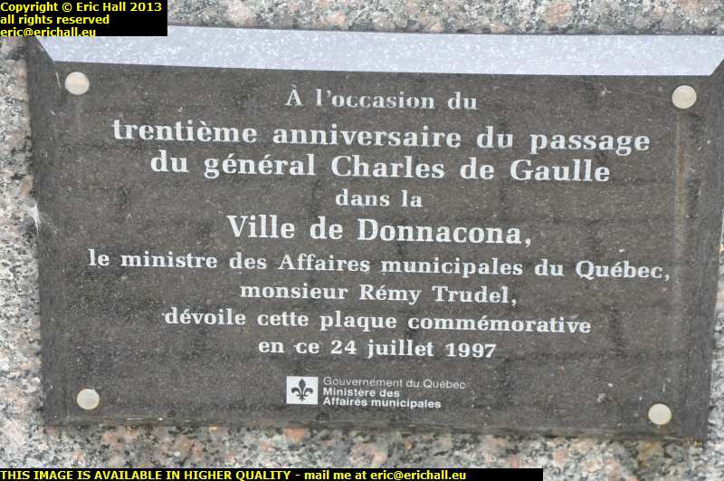
This is a plaque erected in 1967 to celebrate General de Gaulle's passing through the town 30 years previously. You'll notice that it doesn't say "visiting" the town but "passing through" the town.
It does rather smack a little of desperation to erect a plaque with this kind of legend on it. I wonder if anyone will ever erect a plaque in any of the towns that I ever drove through on my travels.
But it did bring a little smile to my face as I recalled a couple of other plaques that I have encountered on my travels.
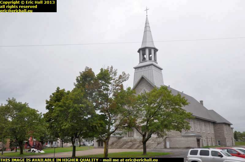
Our road leads us past the church which is of a simple, straightforward design that I find quite pleasing. Yes, there's clearly something wrong with me - that's two churches, this one and the one at Yamachiche that have merited my approval.
As for the collection of artefacts surrounding the church, it isn't a load of scrap awaiting colection but a reminder of Donnacona's industrial past.
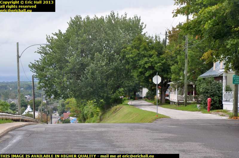
So back in the Dodge and follow the Chemin du Roy out of the town eastwards towards the city of Quebec.
We've just driven up that hill behind us there, and that's clearly an "engineered" road. The road on the right looks much more interesting with its period houses. That road travels along the level for a hundred yards or so and then there's a sudden drop of about one in three. Now that would really tax your diligence.
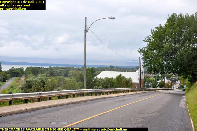
A quick look over the side and you can see how high we've climbed over this last few hundred metres. And as I say, this is a modern "engineered" road.
My attention is however drawn to the road that you can see to the left, running along the edge of the floodplain. I wouldn't have thought that Lanouiller would have brought his road up that steep bank to my right without having made an attempt to run it elsewhere first, and that down there looks quite suggestive.
Retracing my steps a little way to the foot of the hill I find a road on my left (the southern side) called the rue du Couvent. That's always significant in Quebec-as they put convents in all kinds of strategic places.
So if you fight your way through the weeds and rubble at the far end of the street and then cross the railway line, you end up in the rue du Quai and that is much more optimistic.
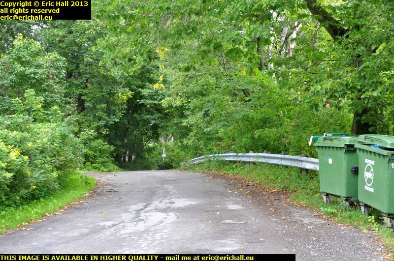
So following the road that we saw, we arrive close to the river bank and there are a couple of likely candidates for an old trace of the Chemin du Roy - one going straight on and the other curving round to the left.
The one straight on takes us down to the river bank and then simply ends at the shoreline. And that, I'm afraid is your lot as far as that one goes.
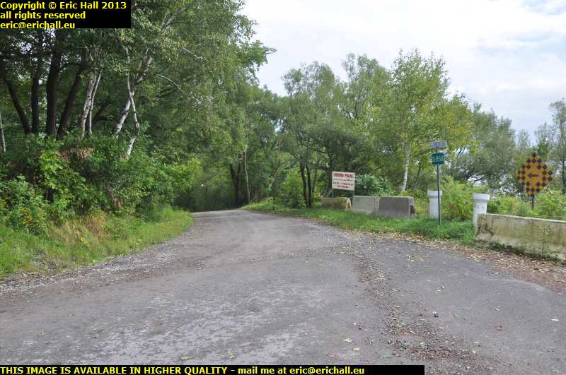
The one to the left, called the route du Bord de l'Eau, does indeed follow the water's edge, carefully skirting around a few evident spots where coastal erosion has taken its toll.
It's significant that it's called a route. If it had been called a rue - a "street", or a chemin - a "lane", then that would not have meant very much, but a route definitely implies that it's a road that's travelling with a purpose between two fixed points some reasonable distance apart.
But I did notice a spur that came in from my right that might, without much stretching of the imagination, have lined up with the first road that we tried had there been any land there for the road to be built on.
Further along the road though, it ends with another Chemin Privé sign across the road and that brings our exploration of this particular route to an end. The sign just there makes me believe that there is no exit out of the other end - it would be very unusual indeed to sell a through-road into private hands.
I did have a quick look at the soil at the water's edge and it is, as I expected, nothing but compacted silt. Nice and fertile for growing crops, but no rocks or stones that would withstand any devastating flood or fast-flowing current.
As we know, Lanouiller experienced all kinds of problems with coastal erosion and a good part of the first trace of the Chemin du Roy was swept away. Having seen the soil in a few of the more doubtful spots along here, I'm not in the least surprised if that had happened just along here.
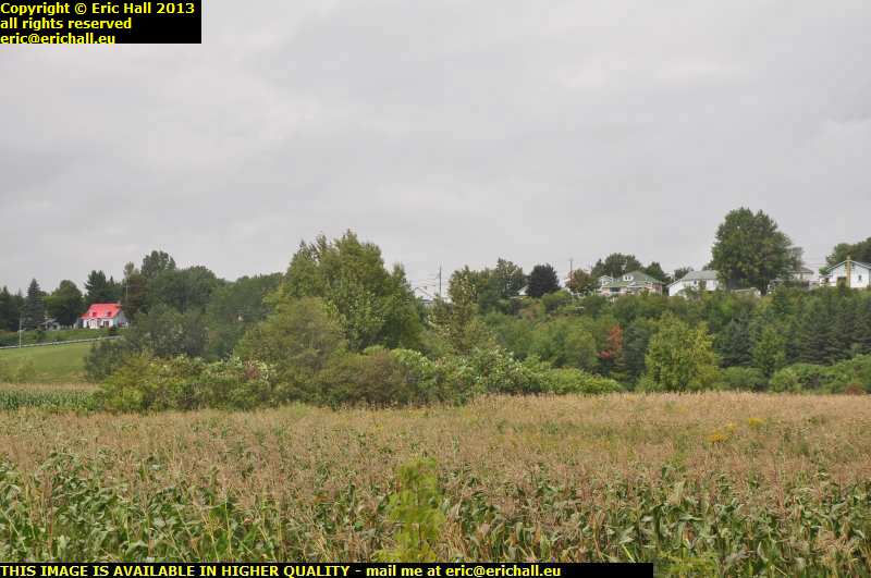
So on the way back to rejoin the modern road and you can see where I was a few minutes ago - somewhere up there near the red house. That's certainly a steep climb but having seen what happened around here, it's no wonder that they re-routed the road up the steep bank and onto the top.
And you can see exactly what I mean by "fertile flood plain", can't you? All of the silt brought down and deposited here by the spring floods is a wonderful boon for agriculture.
And in other news, the sun has come out and in the last couple of minutes, the outside temperature has increased by 5°C. If it carried on like this, we might even have some summer
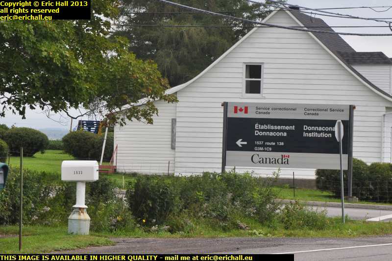
Another claim to fame of the town of Donnacona is that it is the site of the local Nick.
I didn't go for a look around or a sightseeing tour because, as you know, I can usually manage to end up in places like this on my travels without actually asking. Consequently I merely took a photo to record its existence and then hurried along my way before they came to get me.
You may recall that when I set out on the 2012 edition of this journey I made the comment that I was looking forward to travelling around Canada in the Spring without any vegetation blocking my view. I've also been saying that there is only one meander in the whole length of the St Lawrence downstream from Montreal, and of course we drove past that a short while ago.

It's all just one straight line now directly to Québec and so if this photo works, it will be wonderful.
I drove up over a the brow of a long steep hill just past the Nick and away in the distance I saw what I reckoned to be the bridge on the outskirts of Québec, well over 20 miles away. I've recently spent an awful lot of money on a decent 70-300mm zoom lens - 300mm being about 8 times magnification in digital imaging - and I spent all of this money for occasions just like this.
As you can see, it's money well-spent.
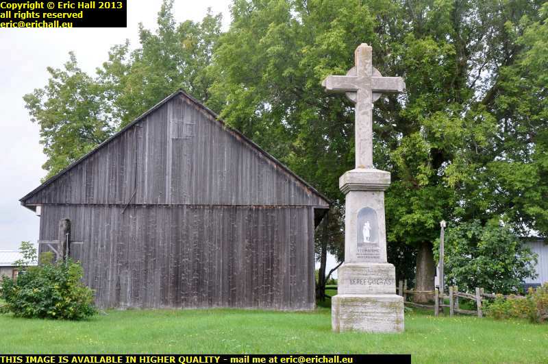
Next stop along our route was the town of Neuville. However we haven't finished with the sights yet. Just before the town is this delightful wayside calvaire and I have to stop for a butcher's.
The obvious question is "just why would the family of Neree Gingras erect a statue of St Christopher - the patron saint of Travellers - to her or him in 1909 and ask him - the Saint, one imagines - to pray for all of us?" If you know the answer to this question, .
©