 | CAPE BRETON ISLAND |
THE CANSO CAUSEWAY
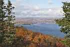
Leaving Baddeck I'm greeted by a sign telling me that I'm only 44 kilometres from the Canso Causeway and hence mainland Nova Scotia. It's at this point that "The Scenic Drive" comes to an end, which is quite a shame as it certainly lived up to its name - a rare event I know when we are talking Tourism.

And with the end of "The Scenic Drive" we now find ourselves in farming country - and real farming country too, with fields and barns and hay rolls and hedges and and all kinds of things like that. There are even people out there doing farming-type activities as well.
How long is it since we've seen any of this? Somewhere round about Québec City I should think and that was about a hundred years ago.
I can't remember whether it was before or after the photograph above that I came to the town of Whycocomagh. It was certainly round about here somewhere. It was getting on towards lunchtime and I've been running low on supplies, but here at Whycocomagh was a large Co-operative Store kind of place. This gave me an opportunity to stock up with a few things. After all, the idea of spending any time at all in North America without an adequate supply of Root Beer on or about my person is unthinkable.
The day that someone starts to import proper Root Beer into Western Europe will be one of the happiest days of my life. Dandelion and Burdock just isn't the same, even when I can manage to lay my hands on some.

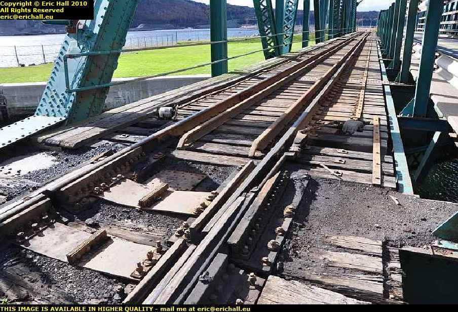
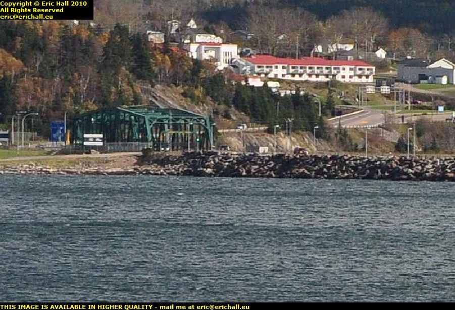
Well, folks, here we are. This is Port Hastings, that in the foreground is the railway line to Sydney that we saw this morning, behind it are the Canso Strait and the Canso Causeway, and over there is the mainland of Nova Scotia.
Where I am is actually the Tourist Information Centre at Port Hastings. I shall be staying for a few days in Nova Scotia, what with one thing and another, and it makes sense to track down an accommodation booklet so I can work out suitable places at which to stay. Here would be a likely place to find the aforementioned, and I was right as well.
This is the third time that I've been over the Canso Causeway - the first time was on my way over to Cape Breton in 2003 and the second time was on my way back. On the first occasion, it was in the gathering gloom and the driving rain and neither Kate Bush nor Jenny Agutter could have lured me out of the car in that. On the second occasion I was in the middle of a major health issue.
But never mind - third time lucky. The weather was nice even though it was blowing a howling gale (and STILL no wind turbines) and so I resolved to leave the car and go for a wander around.
I wrote a little about the history of the Canso Causeway on my first visit across and so I won't bore you - "why stop now?" ...ed - with repeating any of it .

But I'm sure that you are wondering why there are locks in the canal that links St George's Bay in the north with Chedabucto Bay in the south. Surely we are at sea level, seeing as it's the sea, and the canal is probably not even 500 metres long - "it's actually 570 metres long" ...ed. So why the locks?
The answer to that conundrum is the tide. The tide from the north is at a different time than the tide from the south and with the passage through the Strait being compressed into such a small passage the tides would create an enormous tidal bore passing up and down the canal 8 times every day and this would create quite a hazard to seagoing traffic in the canal. And hence the lock gates, to regulate the flow.
And while we are on the subject, I remember hearing of F E Smith (later Lord Birkenhead) at a dinner one evening listening to the speaker droning on and on and on, and then announcing that he had just been elected to the chair of a local rifle club. Smith, not known for his tact and diplomacy, interjected
"small-bore, I suppose".
We said that there's a canal through the Causeway, and you have probably noted the bridge that takes the road and the railway across to the mainland. Then, perhaps, you are wondering how does maritime traffic pass up the canal.
I was wondering that as well and so I went for a brief inspection. And here is the answer. If you look very carefully at the bed of the bridge and the rails of the railway line you will notice that they are in an arc. What we have here is a swing bridge - one that pivots 90° in the horizontal plane to clear the mouth of the canal so that ships and boats can pass.
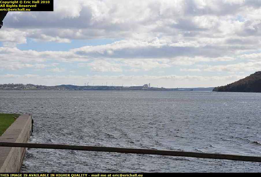
I poked the Nikon through the girders of the bridge to take a photo downstream towards the Chedabucto Bay and the Atlantic Ocean, seeing as how today was the kind of day and the kind of weather where you could do things like that.
Right up there on the left of the image is Port Hawkesbury - an important port for deep-water ships - and just after is Point Tupper - "Tupper? Where?" ...ed
If you have read the story of my visit here in 2003 you will recall that the weather then was dark, gloomy and soaking wet, and that the photos that I took that afternoon (because it was an afternoon, believe it or not) were depressing. Whatever I took of the Causeway, without leaving the vehicle, just didn't work at all.
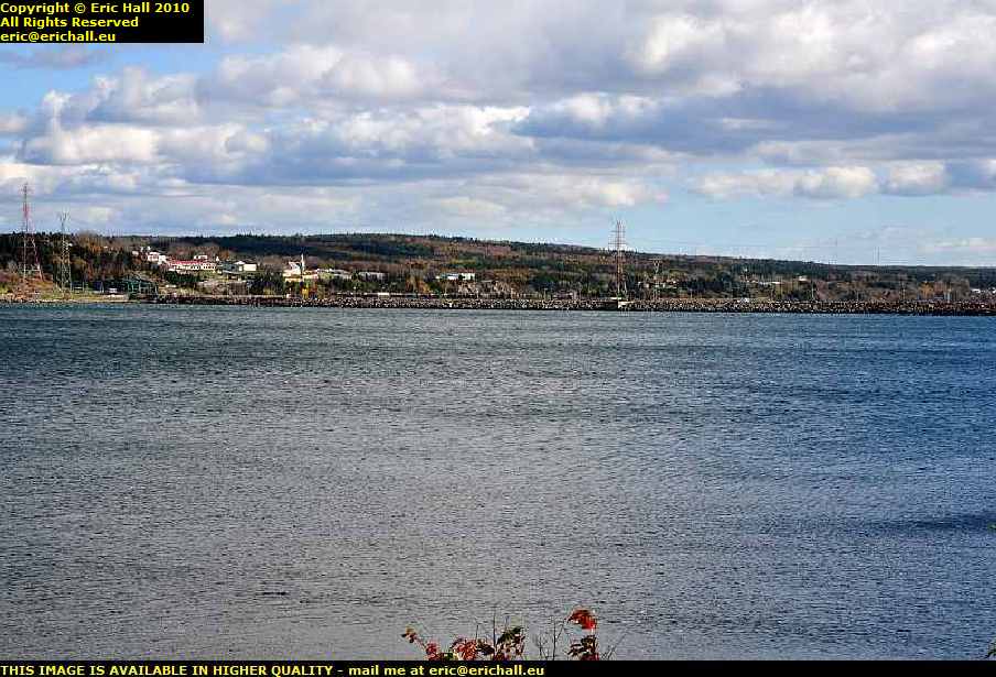
But not so today. We are having some beautiful weather and I could leave the car with impunity (but actually I left impunity inside and went out on my own) and photograph what I liked. This called for a journey across to the mainland of Nova Scotia (I was going that way, anyway) and from a suitable parking area there was an excellent view of the Causeway.
As an aside, the Strait is about 200 feet deep just there, so it took about 10 million tons of rocks to build the causeway. And with such a depth with reference to such a narrow distance as this - it's about 4500 feet, or 1.4 kilometres across - you would be excused for thinking that we are talking of a geological fault line here. You would in fact be correct because the Chedabucto Faultline does run right through here.
And with a little judicious cut-and-paste out of the above phorograph I can even show you a good photograph of the bridge across the canal from here.
On the right-hand edge of the photograph above the bridge is a roundabout (yes, they even have them here too). The left turning there is the coastal road that leads to the Cabot Trail that I came down in 2003 . To the right is the road along the south-eastern coast to Sydney, that I took from here in 2003 and is also where the Visitor Centre, or Tourist Information Office might be found and from where I took the first photo of the Causeway. The road straight on is the route to Sydney via Baddeck and that is the road from whence I have come this morning.
Now just here on the Nova Scotia side of the Canso Strait might be a parting of the ways for us, after all of the journey that we have travelled together (and I bet it's the best part of 4000 kilometres since we left Baie Comeau together all those years ago)
For me, I'm going on to the town of Canso and then along the coast to Halifax. I'll be briefly touching on the Circular Route at Port Glasgow and Port Elgin on my way over to see my family on the western border of New Brunswick and I shan't really be back along the Route until Bathurst.
If you want to take the Circular Route back to Baie Comeau without any of the deviations, then you need to take the route that I travelled in 2003 along the Northern Nova Scotia and then the North-Eastern New Brunswick coasts until we meet again.
Remember that I came down that way from Bathurst in 2003 so you need to start from the bottom of the relevant pages and work upwards - to do the journey in reverse so to speak, rather like the instruction that I received from Cheshire County Council in 1987 for one of the school journeys that I used to undertake on their behalf when I had my taxi company
"The morning journey shall be from Audlem and then Hatherton and finally Wistaston. The evening journey shall be done in reverse"
You have no idea how many gearboxes I wore out, and I still have the neck problems even now.
©